Generative AI
Summary
I have worked on a few projects which involved generative models like GANs and LLMs.
Understanding LLMs
I recent wrote an small article on parameter distribution of LLMs and app to play around with some open-source LLMs. You can check the blog here.
GANs for satellite image segementation
I worked on the problem of image segmentation in satellite images. Figure below shows a satellite image on the left with segmentation map consisting of roads, water, buildings and forest.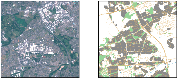
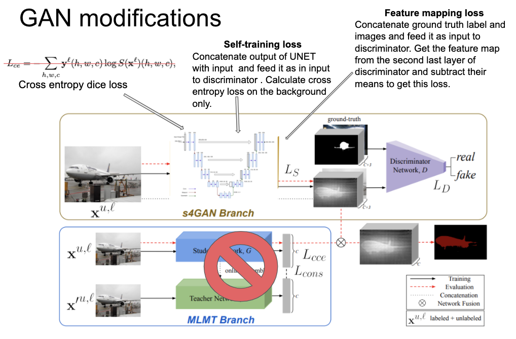
A common problem with segmentation in satellite images is that often the ground truth is not completely labelled, e.g., some roads might be left out of the labels in training data. Training a deep neural network becomes difficult as we do not have the complete ground truth, as such we need to design the loss function such that if we are confident enough in some prediction we incorporate that in ground truth. To do that I used GANs (Generative Adversarial Networks) and borrow ideas from two different studies, UNet and one by Mittal et. al. Additional terms to the loss function were added and some modifications to the latter’s pipeline were made. These modifications yielded better segmentation accuracy for some classes in the dataset.