AI for Earth Observation
Summary
Developed standards and specifications for European Space Agency and worked on image segmentation for EO data.
The story
Earth Observation (EO) data, comprising of data coming from satellites or drones presents vast opportunities for industry and AI. As such, we worked on AIREO with European Space Agency to formulate specifications and standards for EO data so that it can be easily used by the AI community.
We gathered surveys from the community and then specified standards for EO data including what metadata should be present and how we can make it easier to ingest EO data into tools commonly used by AI practitioners. Best practices on how to train ML algorithms on EO data were also laid down.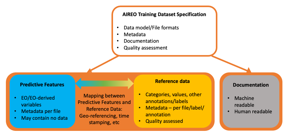
Important links
Link to European Space Agency’s AIREO project
Link to CeADAR’s AI for Earth Observation demonstrator
Publication
- Alastair McKinstry, Oisin Boydell, Quan Le, Inder Preet, Jennifer Hanafin, Manuel Fernandez, Adam Warde, Venkatesh Kannan, and Patrick Griffiths, “AI-Ready Training Datasets for Earth Observation: Enabling FAIR data principles for EO training data”. EGU General Assembly, 2021, link.